Desert Transects
The transects described on this page are located in the Anza-Borrego State Park.
Grapevine Canyon


Leader: Dick Chadwick
Location: Anza-Borrego State Park
Number: 59
Duration: 3-4 hours
Difficulty: Moderate
Why: To offer a counter-argument to the construction of the Sunrise Power Link through the canyon in 2010. The transect is within the Angelina Springs Cultural Preserve (Kevin Smith is a site steward)
What: Cougar, mule deer, gray fox, kangaroo rats, jack rabbits, and more.
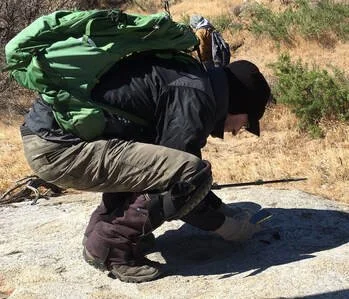
Photos by Evelyn Ono Vineberg, clockwise from photo at right:
- A motley crew on 2 December 2017
- Cougar Track, 2 December 2017
- ABTT Trackers in SDTT shirts, 13 May 2021
- Owl Track, 13 May 2021
- Terry on fox-scat rock, 11 May 2022


The Narrows


Leader: Dick Chadwick
Location: Anza-Borrego State Park
Number: 60
Duration: 4 hours
Difficulty: Easy
Why: This is a low-elevation corridor from the high to the low desert. It is also a min corridor for Bighorn Sheep moving north and south.
What: A cougar was photographed on a camera trap; we observed tracks of Bighorn ewes with lambs. Sheep are occasionally spotted on nearby ridges. Bobcat, jack rabbit, kangaroo rat, and coyote track and sign are regularly seen on this transect.
Photo by Evelyn: 24 November 2019
Photos by Evelyn, evidence of Big-Horn Sheep and
the iconic YWB (yellow water bottle): 11 May 2022

Barrel Springs


Leader: Beth Shugan
Location: Ocotillo Wells State Vehicular Recreation Area (adjacent to Anza-Borrego State Park) with heavy off-road traffic
Number: 61
Duration: 3 hours
Difficulty: Easy; except we have to climb a fence twice. This transect is a square.
Why: The environmental scientist requested the transects to confirm the images caught on their summer camera photos. Originally, there was a coyote-dug water hole in the center of the transect square, but it has moved over the years. This transect is about 2/3rds within a fenced area.
What: We frequently see sign of kangaroo rats, coyote, kit fox, bobcat, black-tailed jackrabbits, and occasionally, roadrunners and gray fox. On occasion we have seen burrowing owl tracks. In the past we were able to confirm for the park that Botta pocket gophers exist in the park, and we also saw ringtail tracks once.
Photos by Evelyn Ono Vineberg
Tule / Eriogonum


Leader: Beth Shugan
Location: Ocotillo Wells State Vehicular Recreation Area (adjacent to Anza-Borrego State Park) with heavy off-road traffic
Number: 66
Duration: 3 hours
Difficulty: Easy. This transect is in a V shape.
Why: The environmental scientist requested the transects to confirm the images caught on their summer camera photos at the year-round water sources, and also to help monitor the impact of off-road vehicles. There are two fenced year-round water sources; one on each of the washes - Tule Wash and Eriogonum Wash.
What: Coyote, bobcat, black-tailed jackrabbit, kangaroo rats, gray fox, kit fox, and occasionally, burrowing owls and Botta pocket gopher
Photo at right by Evelyn Ono Vineberg. August 2017
Photos below by Evelyn, December 2021
Coyote Canyon


Leader: Kevin and Eileen
Location: Anza-Borrego State Park
Number: 70
Duration: 3 hours
Difficulty: Easy
Why: To monitor Coyote Creek, the longest flowing stream in San Diego County. Heavily used rec area.
What: Heavy use by kangaroo rats; also used by coyote, gray fox, bobcat, racoon, jackrabbit, and more. The stream channel changes dramatically with flash floods.
Photos by Eileen Napoleon
